
Quick Answer
Cut and fill is a grading technique that removes soil from the high side of a slope and moves it to the low side to create a level building pad. Fill placed before engineered compaction standards — common on manufactured home sites built in the 1970s and 1980s — has no documented load-bearing capacity. The International Building Code (IBC Section 1804.4) prohibits footings on uncontrolled fill. A geotechnical study confirming fill depth and compaction is required before permit issuance on any structure proposed over historical fill material.
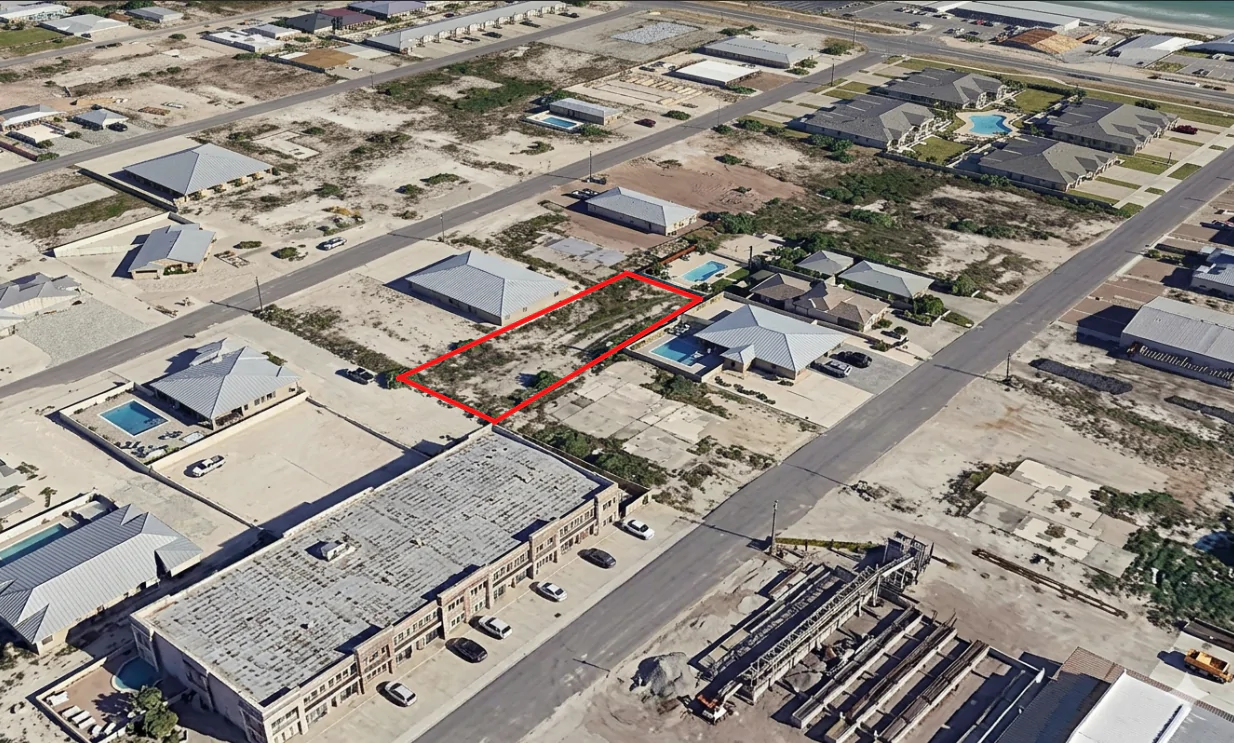
The LiDAR hillshade loaded and the lot told a different story than every aerial photo had.
Google Earth showed a cleared slope. Bare ground. Some scrub. Nothing unusual. But the hillshade showed something different. A flat bench carved into the hillside. A clean cut face on the uphill side. A sloped fill mass running downhill. The shape was unmistakable.
Somebody had cut into that hill around 1978, pushed the soil downhill to level it out, and parked a mobile home on top. The mobile home was gone. The fill was still there. And the owner wanted to build a new stick-built home on the same spot.
Cut and fill is a grading technique. It removes soil from the high side of a slope and moves it to the low side to create a level pad. Fill placed without compaction testing and engineering records, which was common for manufactured home pads built in the 1970s and 1980s, has no documented load-bearing capacity. Building a stick-built foundation on 50-year-old unengineered fill means building on material nobody designed to carry the load. A SiteFacts terrain analysis surfaces this before you commit. Not after. That is the difference between a finding and a catastrophe.
That is the problem. And it is not rare.

What Cut and Fill Actually Means
Cut and fill is how most hillside lots get their level pads. Soil is excavated on the uphill side. That material is moved and placed on the downhill side. The result is a flat bench.
The engineering principle is simple. The execution is what separates a buildable site from a structural time bomb.
Modern controlled fill is placed in layers, typically 6 to 12 inches at a time. Each layer is compacted and tested. The target is 90 to 95 percent of maximum dry density according to ASTM standards. A geotechnical engineer documents every layer. When the work is done, there is a stamped report behind it. When the building department reviews a permit application, there is a paper trail showing what was placed, how it was compacted, and what it can carry.
The 1978 mobile home pad in Lane County had none of that.
HUD adopted standards for manufactured homes in June 1976. Those standards covered the home itself: dimensions, construction, mechanical systems. They did not cover the site. Rural Oregon jurisdictions in that era had limited inspection capacity. What typically happened was this: an excavator operator cut into the hillside, pushed the soil downhill to level the pad, and the mobile home went on pier-and-beam footings. No compaction testing. No documentation. No engineer stamp.
Mobile homes are flexible structures. Pier-and-beam footings can flex as fill settles. Individual piers can be shimmed and adjusted. A poured concrete foundation cannot flex. It sits rigid on whatever is below it.
When uncontrolled fill settles unevenly, and 50-year-old fill on a slope almost always settles unevenly under new foundation load, the foundation cracks. Doors stop closing. Floors go out of level. Diagonal cracks spread through walls. In bad cases, the damage is too expensive to fix.
The fill and native soil also meet at a failure plane. Water moving in from upslope travels along that boundary. Saturated fill on a slope does not stay put.
None of that was visible from the road. None of it showed on aerial photos. It showed up on LiDAR in minutes.
Why This Answer Is Available Now
LiDAR stands for Light Detection and Ranging. An aircraft fires laser pulses at the ground and measures how long they take to return. The result is a precise map of terrain elevation, point by point.
From that elevation data, analysts produce a bare-earth digital elevation model. That is just a map of the actual ground surface with vegetation and structures stripped away. Hillshade rendering then applies simulated directional lighting to that map. Slope breaks, flat benches, cut faces, and fill masses become immediately visible, even when they are 50 years old.
Terrain geometry does not heal. The grading done in 1978 is still readable on the surface in 2026. Fill slopes have a different shape than undisturbed hillside. Vegetation does not erase that shape. Weathering does not erase it. The fill was always there. It was just invisible to every tool that looked at the site until someone ran the terrain data.
The data is public. DOGAMI, Oregon’s Department of Geology and Mineral Industries, maintains LiDAR coverage for Lane County with vertical accuracy under 10 centimeters. That is more than enough to detect a grading bench measured in feet. The USGS 3DEP program covers most of the country at similar resolution. It is available at no cost from the National Map.
SiteFacts uses USGS LiDAR data to run terrain analysis as a standard part of every site evaluation. When a parcel shows slope, prior development, or terrain that suggests past grading, the hillshade is in the report. It is not a special add-on. It runs on every property where it matters.
The answer has always been there. Now there is a systematic way to get it before you close.
What the Data Found: What Lane County Does With It
When slope and prior development appear together on a Lane County property, the terrain data does not just identify a grading question. It triggers a regulatory chain that runs automatically.
Based on SiteFacts analysis of Lane County reports: Lane County requires a geotechnical report when a property is mapped in the Lane County Geotech Map area and shows a suspected landslide area with previous development. That requirement is not triggered by an applicant volunteering a problem or an inspector noticing something on a site visit. The county’s own mapping data triggers it. For this Lane County property, the DOGAMI maps showed very high landslide susceptibility and documented landslide inventory deposits, meaning prior slope failures on the parcel itself. The combination dropped an automatic geotech requirement onto the permit application. Submit without the report and the permit clock stops until you comply. This requirement sits in Lane County Code Title 16, the Natural Hazards provisions, at the Lane County Code library.
The chain did not stop there.
Based on SiteFacts analysis of Lane County reports: for properties mapped in areas of highly erodible soils, Lane County may apply additional erosion control requirements beyond the standard Best Management Practices already required for all new construction. The trigger is the soils designation on county maps, not the applicant’s view of whether erosion is a concern on their specific site. This property sits in an area of Jory and Nekia clay-heavy soils. These soils erode easily when disturbed and are prone to debris flow when saturated. The designation was on the map. The extra requirements followed automatically.
This property was also in a Mercury TMDL area. TMDL stands for Total Maximum Daily Load. It is a water body impairment designation under Section 303(d) of the Clean Water Act. This one was for mercury contamination. A TMDL designation makes erosion and sediment control legally required, not optional, because sediment transport is how mercury moves through affected watersheds.
Based on SiteFacts analysis of Lane County reports: all stormwater must be maintained on site for new construction in Lane County. On a cut-and-fill site with a downslope fill bench, this shapes the entire grading design. The fill slope below the bench is not a drainage path. The site plan has to manage water on site and prevent it from saturating the fill. That has to be part of the design from the start. An afterthought drainage solution on a fill slope in a landslide area will not satisfy the county.
Three non-discretionary regulatory consequences. All triggered by data that exists in public mapping. All surfaced before the owner committed to a design, a contractor, or a permit application timeline. This was a complex permitting project before a single drawing was started. Knowing that before closing changes the budget conversation completely.
Building on Fill Requires Engineering, and Sometimes It Cannot Be Done
Before a building official can issue a permit for a structure on fill, the code requires that a licensed engineer answer for what is under the foundation.
The International Building Code, adopted in Oregon as the Oregon Structural Specialty Code, addresses this directly. IBC Section 1804.4 prohibits footings on uncontrolled fill. There is no workaround. There is no grandfather provision for existing fill. IBC Table 1806.2 explicitly excludes fill from the presumptive bearing values used for native soil. The Oregon Residential Specialty Code, based on the IRC, requires documented engineer approval before a permit can be issued for footings on fill.
Verify specific section numbers and any Oregon amendments against the Oregon Building Codes Division’s current published code: Oregon BCD maintains the OSSC and ORSC at oregon.gov/bcd/codes-stand. Lane County-specific requirements live in LCC Title 16 at library.municode.com/or/lane_county.
What a geotechnical engineer does on a site like this is drill. Three to six borings through the fill and into native soil. Typically 10 to 30 feet deep, depending on fill depth and slope geometry. At regular intervals, they measure the Standard Penetration Test N-value. That is a blow count: how many hammer blows it takes to drive a sampling tube 12 inches. Think of it as a hardness test for soil. An N-value below 10 means the soil is too loose for most residential foundation loads. They classify the soil type, test for expansive potential, and run bearing capacity and settlement analysis.
On a slope with documented prior failures, they also run a slope stability analysis. The result is a factor of safety, which is the ratio of forces holding the slope in place to forces trying to move it. A factor of safety below 1.5 under static conditions, or below 1.1 under seismic loading, is not acceptable.
I have personally seen a soils study on a cut-and-fill site come back unbuildable. That is not the common outcome, but it is a real one.
“Unbuildable” in geotechnical terms is not a legal designation. It is a licensed engineer saying what they cannot recommend. It comes in three forms.
The first is geotechnically unbuildable. No feasible foundation system exists for the site conditions.
The second is economically unbuildable. A technically feasible foundation system exists, but the cost makes the project financially impossible. Removing and replacing uncontrolled fill on a sloped site can run into the tens or hundreds of thousands of dollars before a foundation is poured. Deep piers or helical piles to bypass bad fill and reach competent native soil are expensive.
The third is regulatorily unbuildable. The combination of setbacks, overlay districts, and hazard area restrictions eliminates the buildable area on the parcel regardless of what the soils say.
A geotechnical study on a property like this, with a steep slope, documented landslide deposits, and fill of unknown depth and compaction, typically runs $3,000 to $8,000 and sometimes more when slope stability analysis is required.
That number sounds significant until you hold it next to the alternatives.
Foundation repair after differential settlement on uncontrolled fill can run into six figures. That is not a cost for catastrophic failure. That is the cost of addressing a problem that announced itself slowly through cracked walls, doors that stopped latching, and floors that started to slope. A full foundation replacement is more.
An unbuildable determination after you have already closed on the property means you own land you cannot build on. The title company’s report did not catch it because title reports cover legal encumbrances, not soil conditions.
Pick your expensive.
What You Own When the Analysis Is Complete
When a SiteFacts report comes back on a sloped property with prior development, you own the terrain answer before any money has moved toward design or construction.
You know whether a cut-and-fill bench exists. You know what its geometry suggests about fill depth and stability. You know which regulatory overlays apply and which permit requirements are automatic versus discretionary. You know whether a geotech study is required before the permit application, not after you have already spent money on design. You know the stormwater and erosion control constraints that will shape site design.
You know all of this before closing, when the information is still cheap enough to act on.
You do not need to know what LiDAR is. You do not need GIS software. You do not need to call Lane County Land Management and decode Title 16 section by section. You read the report.
The buyers and builders who get the best outcomes are the ones who close on a property knowing what they are buying. Not the ones who find out after the foundation is poured.
The buyers and builders who get the best outcomes are the ones who close on a property knowing what they are buying.
What This Site Tells Anyone Buying a Lot With Prior Work
This Lane County property is an unincorporated rural residential RR-5 parcel with a specific set of overlay conditions. The geotech requirement was automatic because of the landslide mapping. The stormwater requirement was automatic because of Lane County code. The erosion requirements were layered by soils designation and TMDL status. Not every sloped lot carries all of these at once.
But the pattern this property represents shows up everywhere, in different forms, with different rules. A cleared pad on a slope with no records from the original grading is a cut-and-fill question. It does not matter whether it sits in Lane County, Deschutes County, King County, or Kootenai County. The LiDAR geometry does not care about jurisdiction. The settlement mechanics of uncontrolled fill do not change based on which county issued the original permits. A stick-built foundation on material nobody engineered is a structural risk regardless of how long the fill has been sitting there.
The buyers who get hurt are the ones who close on the site without asking the terrain any questions.
A SiteFacts report on a sloped property with prior development is typically ready within 5 business days. You submit your property address. We pull the terrain data, the hazard overlays, and the jurisdictional requirements. The report arrives within 5 business days. That is before you make an offer. That is before any money moves toward design, engineering, or construction.
Submit your property address at sitefactsreport.com and we will pull the terrain data, the soils mapping, the hazard overlays, and the jurisdictional requirements together into a single report before you commit.
The fill is still there. You need to know what it is before you build on it.
SiteFacts Field Tool
Free Slope Calculator for Builders
Estimating the cut on a sloped lot before you submit? Get percent grade, angle, and ratio from two elevation readings. No login, no friction.
SiteFacts Field Data — Cut and Fill, Lane County, OR
SiteFacts LiDAR terrain analysis of a Lane County, OR rural residential parcel (RR-5 zone) identified a cut-and-fill bench created approximately 1978 for a manufactured home pad. The bench was clearly visible in DOGAMI LiDAR hillshade data (vertical accuracy <10cm) but invisible in Google Earth aerial imagery. The parcel triggered three automatic regulatory consequences under Lane County Code Title 16: a geotechnical report requirement (landslide susceptibility mapping combined with prior development), enhanced erosion control (Jory and Nekia clay-heavy soils in a mercury TMDL watershed), and on-site stormwater retention required for all new construction. Geotechnical study for a site of this complexity: $3,000–$8,000 before permit application. Foundation repair after differential settlement on uncontrolled fill typically runs $50,000 to six figures. SiteFacts LiDAR terrain analysis is standard on every sloped parcel evaluation.
Source: SiteFacts site evaluation, Lane County, OR. sitefactsreport.com
Tools
- Slope Calculator Calculate slope, grade, and angle from elevation and distance
- Dirt Balance Calculator Estimate cut and fill volumes for site grading
- Development Budgeting Tool Plan your land development budget before you commit
Related Reading